
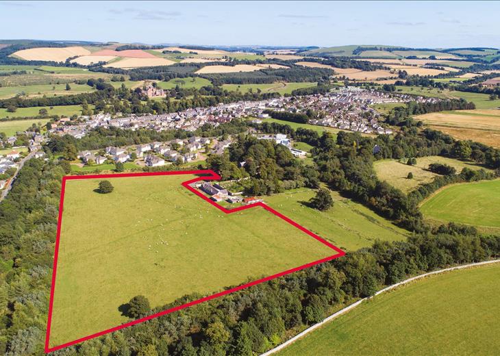
If you own a piece of land — whether it’s a large garden, paddock, field, redundant building or commercial property — you may be wondering whether it could have development potential.
The answer depends on the individual site. Location, planning policy, settlement boundaries, access, environmental constraints, existing buildings and the type of development being considered can all affect whether land is suitable for development.
This guide explains the key factors that planning professionals consider when assessing land, the types of sites that may have development potential, and what you can do to establish whether your own land is worth exploring further.
The Short Answer
Your land may be suitable for development, but owning land does not automatically mean you can build on it.
A site may have development potential even when it does not currently have planning permission. Equally, land that appears suitable at first glance may have planning, access, environmental or other constraints that make development more difficult.
The important question is therefore not simply “Can I build on my land?”, but “Does this particular site have a realistic planning route for development?”
A site-specific assessment can help establish where your land sits within the planning framework, what opportunities may exist, what constraints need to be considered and which route, if any, may be worth pursuing.
What Does “Development Potential” Actually Mean?
Development potential means that a piece of land may have a realistic planning route for a new use or form of development.
This could include:
- New homes or residential development
- Conversion or redevelopment of existing buildings
- Commercial or employment uses
- Extensions or development within an existing residential curtilage
- Energy or infrastructure uses
- Other forms of development that may be appropriate for the location
Land does not necessarily need to have planning permission already in place to have development potential. A site without permission may still have a possible planning route, depending on its location, planning policy, physical characteristics, constraints and the type of development being considered.
Equally, development potential does not mean that planning permission is guaranteed. The purpose of an initial land assessment is to establish whether there appears to be a realistic opportunity worth investigating further and what planning route may be appropriate.
The key factors are explained below.
The 7 Key Factors That Determine Whether Land Is Suitable for Development
1. Location and Proximity to Existing Development
Where your land is located, and how it relates to existing development, is one of the first things to consider when assessing its development potential.
Land within an existing settlement, or land that is physically well related to an existing town or village, may have a more obvious planning route than land that is isolated from established development. However, being close to a settlement does not by itself mean that planning permission will be granted.
Planning professionals will typically consider questions such as:
- Is the land within an existing settlement or settlement boundary?
- If it is outside the settlement, is it physically well related to the existing built-up area?
- Does the site adjoin existing development, and what is the character of that relationship?
- Is there a realistic opportunity to provide safe pedestrian and vehicular access?
- Is the site reasonably well connected to services, facilities, employment and public transport?
- Is there a railway station or other sustainable transport opportunity within a realistic walking distance?
- Would development result in an isolated or poorly connected form of development?
The relationship between a site and the settlement around it can be particularly important for land on the edge of towns and villages. A site immediately adjoining a settlement may warrant further investigation even where it currently sits outside the settlement boundary.
Equally, land that is technically close to a settlement may still face significant planning issues if there are physical barriers, poor access, intervening countryside or other constraints separating it from the existing built-up area.
Location therefore needs to be assessed in context — not simply by measuring the distance to the nearest settlement on a map.
This is why an initial assessment should look at the site’s actual relationship with surrounding development, transport connections, services and the wider planning framework.
2. Planning Policy Designation
Every site sits within a planning policy framework that helps determine what forms of development may be appropriate. This includes national planning policy, the policies in the relevant Local Plan and any specific designations or constraints affecting the site.
Understanding the planning position is therefore an essential part of assessing whether land may have development potential.
Common situations include:
Land within a settlement — Development within an existing settlement may benefit from the services, facilities and infrastructure already available, although proposals still need to comply with the relevant planning policies and other requirements.
Land adjoining a settlement — Land on the edge of an established town or village can sometimes have development potential, particularly where it is physically well related to the existing built-up area. The settlement boundary, local planning strategy, surrounding development and site-specific constraints all need to be considered.
Green Belt land — Green Belt designation does not mean that no development can ever take place. National policy identifies circumstances in which development may be appropriate, including specific exceptions and provisions relating to Grey Belt and previously developed land. The particular site and proposed development still need to be assessed against the relevant policies.
Grey Belt land — The current National Planning Policy Framework provides a specific policy framework for identifying and considering Grey Belt land within the Green Belt. However, land being identified as Grey Belt does not automatically mean that it should be released or that planning permission will be granted. Other planning considerations and the circumstances of the proposed development remain important.
Brownfield / Previously Developed Land — Previously developed land can benefit from national planning support for its effective reuse, subject to the formal definition of previously developed land and the policies and constraints applying to the site. Not all previously used or previously occupied land falls within the formal definition.
Agricultural land — Agricultural use does not automatically prevent development. Potential routes can include appropriate agricultural development, certain permitted development rights, conversion of qualifying buildings or development through the planning system where the location and circumstances support it. For example, qualifying agricultural buildings may have potential under Class Q permitted development rights.
Residential gardens and curtilage — Residential land within an existing built-up area can have development potential, but garden land should not simply be assumed to be previously developed land. Its planning position needs to be considered separately, including the relationship with the existing dwelling, surrounding development and the relevant national and local policies.
Commercial and industrial buildings — Existing commercial buildings may have potential for continued commercial use, conversion, redevelopment or, where the relevant requirements are met, permitted development routes. The building’s existing use, lawful planning status, location and physical characteristics all need to be considered.
Roadside land and land suitable for EV charging — Highway-facing or roadside land can sometimes have potential for uses such as EV charging, drive-thru or other roadside development where there is suitable access, visibility, demand and an appropriate planning route. EV charging, drive-thru and other roadside uses each have their own planning and operational considerations.
Equestrian land and properties — Equestrian sites can have potential through the reuse of existing buildings, changes of use or, in some circumstances, longer-term planning or land promotion. The existing lawful use, buildings, location and surrounding planning context all need to be assessed.
Conservation Areas, Listed Buildings and other heritage constraints — Heritage designations can add important considerations, but they do not necessarily prevent development. The significance of the heritage asset, its setting and the effect of the proposed development need to be assessed.
A site’s designation is only one part of the assessment. Two sites with the same designation can have very different development prospects because of their location, access, landscape, ecology, flood risk, infrastructure and relationship with surrounding development.
The important question is therefore not simply “What designation is my land?” but “How does that designation affect the particular development opportunity on my site?”
A proper assessment brings these factors together to establish whether there appears to be a realistic planning route and whether the opportunity is worth investigating further.
3. Size and Configuration of the Site
The size and shape of your land can affect what type and scale of development might be possible, but there is no single minimum site size that automatically determines whether land is suitable for development.
A small site may have potential for one or more homes, while a larger site could potentially accommodate a wider development or be considered for longer-term promotion. The appropriate scale depends on the site’s location, planning context, access, surrounding development and the characteristics of the land.
The assessment will consider questions such as:
- How large is the site and what proportion of it could realistically be developed?
- What is the shape and configuration of the land?
- Could a suitable layout be achieved?
- Does the site have sufficient space for access, parking, landscaping, drainage and other requirements?
- How does the size of the site relate to surrounding development?
- Could the site accommodate a form of development that is appropriate to its location?
Different types of land can present different opportunities. For example:
- Large gardens and residential plots may have potential for additional homes where there is sufficient space, suitable access and an appropriate relationship with the existing property and surrounding development.
- Greenfield land adjoining settlements can range from smaller infill opportunities to larger sites that may warrant longer-term planning or land promotion.
- Existing commercial buildings may have potential for conversion or redevelopment depending on the building, its lawful use, location and the applicable planning route.
- Agricultural buildings and barns may offer opportunities for conversion where the relevant permitted development or planning requirements are met.
- Roadside sites can sometimes have potential for uses such as EV charging, drive-thru or other roadside development where the location, access and commercial requirements are suitable.
The physical characteristics of the site are also important. Irregular boundaries, steep slopes, watercourses, existing trees, overhead power lines, easements or neighbouring properties can all influence how much of the land could realistically be developed.
These constraints do not necessarily prevent development. The important consideration is how they affect the usable area, potential layout, access, costs and overall planning case.
For larger or more complex sites, the assessment should therefore consider not simply the total acreage, but the developable area and the type and scale of development that the site could realistically accommodate.
4. Access and Infrastructure
A site may appear suitable for development, but access and infrastructure can have a major influence on whether a proposal is realistically achievable.
Planning authorities will consider whether development can be served by safe and suitable access, while also considering matters such as drainage, water supply, electricity, foul drainage, highways and other infrastructure requirements.
Questions that may need to be considered include:
- Can safe vehicular access be provided?
- Could suitable pedestrian access be achieved?
- Is there sufficient visibility at the proposed access?
- Can the site connect to the required utilities and drainage infrastructure?
- Would development place unacceptable pressure on local roads or infrastructure?
- Are there existing rights of way, easements, covenants or other access issues affecting the site?
Good access does not necessarily mean that your land needs to front directly onto a major road. What matters is whether a safe and appropriate access arrangement can realistically be achieved for the type and scale of development proposed.
Similarly, a lack of an existing mains connection does not automatically mean that development is impossible. The feasibility and cost of providing services need to be considered alongside the proposed development and the site’s overall viability.
For some sites, access may be one of the main planning constraints. For others, it may be capable of being resolved through the design of the development.
This is why access should be considered at an early stage rather than assuming that a site is suitable simply because it appears well located.
5. Flood Risk
Flood risk is an important consideration when assessing whether land may be suitable for development, particularly where residential or other vulnerable uses are being considered.
The Environment Agency’s flood risk mapping can provide an initial indication of whether land is within Flood Zone 1, 2 or 3, although the planning assessment may need to consider other sources of flood risk as well.
The assessment may consider:
- The site’s Environment Agency Flood Zone.
- Surface water flood risk.
- Existing watercourses, drainage channels and ordinary watercourses.
- The potential impact of development on drainage and surface water.
- Whether a Flood Risk Assessment or other technical work may be required.
- Whether the proposed use is appropriate for the level and type of flood risk affecting the site.
Being within an area identified as having flood risk does not automatically mean that development is impossible. However, flood risk can materially affect the type, layout and location of development that may be appropriate and can introduce additional technical requirements.
For some proposals, the planning process may also require consideration of the Sequential Test and, where applicable, the Exception Test.
Flood risk should therefore be checked at an early stage. A site that looks attractive on a map can face significant constraints if development would be poorly located in relation to flood risk or drainage.
6. Ecological and Environmental Constraints
Ecology and environmental constraints can affect both the principle and design of development. They should therefore be considered early rather than treated as an issue to investigate only after a site has been identified as potentially suitable.
Potential matters include:
- Protected species and habitats.
- Ancient woodland and veteran trees.
- Sites of Special Scientific Interest (SSSIs).
- Local wildlife sites and other designated habitats.
- Hedgerows, trees, ponds, watercourses and other ecological features.
- Landscape and visual impacts.
- Potential biodiversity impacts arising from the proposed development.
A preliminary ecological appraisal or other ecological survey work may be appropriate depending on the site and the type of development being considered.
Biodiversity Net Gain
In England, Biodiversity Net Gain (BNG) forms part of the statutory planning framework for relevant development. Where BNG applies, the objective is generally to achieve at least a 10% increase in biodiversity value.
However, not every development is subject to the statutory BNG requirements. From 6 August 2026, planning applications for developments with a red-line site area of 0.2 hectares or below are exempt from BNG, subject to the applicable conditions. There are also other exemptions, including certain temporary developments and the existing de minimis provisions.
The presence of priority habitat can affect whether an exemption applies, so the position should be checked against the specific site and proposal.
For developments that are subject to BNG, biodiversity should be considered early in the design process. Habitat impacts, opportunities for on-site enhancement and any potential off-site requirements can all affect the layout and economics of a scheme.
Ecological constraints do not necessarily prevent development. The important question is whether they can be avoided, mitigated or appropriately addressed through the design and planning process.
7. Market Demand in Your Location
Planning potential and commercial potential are not always the same thing. Even where a site appears capable of obtaining planning permission, its value and attractiveness will depend partly on whether there is a market for the type of development that could realistically be delivered.
For residential land, this can include consideration of:
- Local demand for new homes.
- Recent sales values for comparable properties.
- The type and size of homes that are being sold locally.
- The number of homes that could realistically be delivered on the site.
- Whether the location is attractive to local purchasers or occupiers.
For commercial or alternative uses, the assessment may instead consider factors such as:
- Local employment and business demand.
- Road access and visibility.
- Proximity to existing commercial areas and services.
- Demand for particular uses in the area.
- Whether an operator, investor or developer market exists for the opportunity.
Market demand can therefore influence both what type of development may make sense and how attractive the opportunity may be to a developer or land promoter.
This does not mean that a site needs to be in a high-value area to have development potential. Different locations support different types and scales of development, and the appropriate opportunity needs to be assessed on its own circumstances.
A proper land assessment therefore considers the planning position alongside the likely development opportunity and local market evidence.
Could Your Land Have Development Potential?
The seven factors above provide a starting point, but every site is different. Our free land assessment reviews your site’s planning position, location, constraints and potential development options to help you understand whether it is worth exploring further.
Get My Free Land Assessment →No cost · No obligation · Reviewed personally by our team
Types of Land That May Have Development Potential
Development opportunities can arise from many different types of land and property. The planning route will depend on the individual site, but the following pages explain some of the opportunities we regularly assess for landowners.
- Large Gardens — Potential for additional homes or other development within suitable residential plots.
- Commercial Buildings — Opportunities involving redundant, underused or surplus commercial and industrial buildings.
- Class Q Barn Conversions — Potential residential conversion of qualifying agricultural buildings under permitted development rights.
- Brownfield and Previously Developed Land — Redevelopment and reuse opportunities associated with previously developed sites.
- Equestrian Land — Potential opportunities involving equestrian properties, buildings, paddocks and former equestrian uses.
- Roadside and EV Charging Land — Potential commercial and infrastructure opportunities for suitable roadside locations.
- Green Belt Land — Understanding the Green Belt designation and the circumstances in which development may be possible.
- Grey Belt Land — Understanding whether Green Belt land may meet the current Grey Belt definition and what that could mean for development.
If your land doesn’t fit neatly into one of these categories, that doesn’t mean it has no potential. The planning position, location and characteristics of each site need to be considered individually.
Find Out If Your Land Has Development Potential →
What Happens When You Get a Professional Land Assessment?
A professional land assessment is an initial review of your site’s planning position and potential development opportunities. It is designed to help you understand whether your land appears worth exploring further before committing to significant planning costs.
At Revive Estates Group, our assessment considers a range of information about your particular site, including:
- Location and settlement relationship — how the site relates to existing development, settlements, services and transport.
- Planning policy — the relevant national and local planning framework and any important policy designations affecting the land.
- Planning history — previous applications, decisions and other relevant planning information relating to the site or surrounding area.
- Site constraints — matters such as access, highways, flood risk, ecology, landscape, heritage and infrastructure that could affect development.
- Potential development routes — whether there may be an opportunity through planning permission, permitted development, conversion, redevelopment, land promotion or another appropriate route.
- Potential scale and use — where possible, considering what type and scale of development could be appropriate based on the site’s characteristics and planning context.
- Market considerations — considering the type of development that may have a realistic market in the location.
The purpose is not to promise that planning permission will be granted or to provide a formal valuation. Instead, the assessment helps establish whether there appears to be a realistic opportunity worth investigating further.
Where there appears to be potential, we can then discuss the possible next steps, which may include further planning investigation, a planning application, land promotion, an option agreement, an outright sale or another strategy appropriate to the site.
If significant constraints are identified, we will explain those too. Understanding why a site may face difficulties can be just as important as identifying an opportunity.
How Much Could Your Land Be Worth?
Land value can vary significantly depending on what the land can realistically be used for and how certain that development opportunity is.
There is no single value that can be applied to all development land. A site’s potential value may be influenced by:
- Location — including local property values, demand and the site’s relationship with existing settlements.
- Planning status — whether planning permission exists, a permitted development route may apply, or further planning work is required.
- Development potential — the type, scale and number of uses or units that could realistically be delivered.
- Site constraints — including access, highways, drainage, flood risk, ecology, infrastructure and abnormal costs.
- Planning risk and certainty — the amount of work and uncertainty involved in achieving the proposed development.
- Market demand — the level of demand from developers, purchasers, occupiers or other potential end users.
For example, land with an implementable planning permission can have a very different value from land where development is only a possibility that still requires significant planning work. Similarly, two sites of the same size can have very different values because of their location, development capacity and constraints.
This is why simply comparing your land with another site based on its acreage can give a misleading impression of value.
If your land appears to have development potential, establishing the likely planning route and understanding what could realistically be delivered is an important first step before considering its market value.
Read our guide: How Much Is My Land Worth to a Developer? →
Common Myths About Land Development Potential
There are several common assumptions that can cause landowners to dismiss the possibility of development before their land has been properly assessed.
“My land is Green Belt, so it can’t be developed.”
Green Belt designation can make development more challenging, but it does not mean that every form of development is prohibited. National planning policy identifies circumstances in which development may be appropriate, while the current framework also includes provisions relating to Grey Belt and other specific development opportunities.
The important question is how the Green Belt designation and the relevant policies apply to your particular site and the development being considered.
Read our guide to Green Belt land and development →
“My garden is too small to have any development potential.”
There is no universal minimum garden size that determines whether development is possible. The size and shape of the plot, access, relationship with surrounding development, local planning policies and the potential layout all need to be considered.
Even a relatively small residential plot may be worth investigating where the planning circumstances and site characteristics are appropriate.
Find out more about development potential in large gardens →
“I would have to spend a lot of money on planning before knowing whether my land has potential.”
Not necessarily. An initial assessment can identify obvious planning opportunities and constraints before significant professional costs are committed.
If a site appears to have potential, further work may then be appropriate. Depending on the circumstances, this could involve a planning application, permitted development route, land promotion, an option agreement or another strategy.
“A developer has approached me, so I know exactly what my land is worth.”
An approach from a developer can be an indication that someone sees potential in the site, but it does not necessarily establish the land’s market value or mean that the proposed terms are right for you.
Before agreeing to sell or enter into an option or promotion agreement, it is sensible to understand your land’s planning potential and the basis on which any offer or proposal has been made.
Read our guide: A Developer Has Approached Me About My Land — What Should I Do? →
“Planning takes too long to be worth pursuing.”
Planning timescales vary considerably depending on the development route, the complexity of the proposal and whether further planning or technical work is required.
Some permitted development routes can have defined decision periods, while larger or more complex planning and land promotion projects can take considerably longer. The potential opportunity therefore needs to be considered alongside the likely timescale, cost and risk.
Think your land might have potential?
The only way to understand how these factors apply to your land is to look at the individual site. Our free land assessment considers the planning position, location, constraints and potential development routes to help you decide whether the opportunity is worth exploring further.
No cost · No obligation · Reviewed personally by our team
What Should You Do Next?
If you’ve read this guide and think your land might have development potential, the next step is to understand how the planning principles and constraints discussed above apply to your particular site.
At Revive Estates Group, we offer a free, no-obligation land assessment for landowners across the UK. We review your site’s location, planning position, relevant constraints and potential development routes to give you a straightforward view of whether the opportunity appears worth exploring further.
There is no cost for the initial assessment and no obligation to proceed with any further service. If we identify potential, we can discuss the options available to you and the most appropriate next steps.
Depending on the circumstances of your land, this could include further planning investigation, a planning application, land promotion, an option agreement, an outright sale or another appropriate strategy.
If significant planning or other constraints are identified, we will explain those too. The purpose of the assessment is to help you make an informed decision about your land before committing to significant costs or a particular route.
Find Out If Your Land Has Development Potential
Tell us about your land and we’ll review the planning position, location and potential development opportunities.
Get My Free Land Assessment →No cost · No obligation · Reviewed personally by our team
Frequently Asked Questions
What makes land suitable for development?
There is no single factor that determines whether land is suitable for development. Planning professionals will typically consider its location, relationship with existing development, planning policy, access, site characteristics, flood risk, ecology, infrastructure and the type of development being proposed.
Market demand and the potential scale of development can also be relevant when considering whether an opportunity is worth pursuing.
Can land outside a settlement boundary have development potential?
Yes. Land outside a settlement boundary is not automatically unsuitable for development. The planning position will depend on the location of the site, its relationship with the existing settlement, relevant national and local planning policies and any site-specific constraints.
Land adjoining or physically well related to an existing town or village can sometimes present opportunities, although this does not mean that planning permission will automatically be granted.
Can Green Belt land be suitable for development?
Yes, in certain circumstances. Green Belt policy places particular controls on development, but national planning policy identifies circumstances in which development may be appropriate. The current framework also includes provisions relating to Grey Belt land and other specific development opportunities.
Whether a particular Green Belt site has development potential depends on its individual characteristics, planning context and the type of development being considered.
Read our guide to Green Belt land and development →
Does land need planning permission before it has development potential?
No. Development potential simply means that there may be a realistic planning or permitted development route for the site. Land can have potential even when no planning permission is currently in place.
Depending on the circumstances, the appropriate route could involve permitted development rights, a planning application, conversion or redevelopment, land promotion, an option agreement or another strategy.
How can I find out if my land is suitable for development?
The best starting point is a site-specific assessment. This should consider the site’s location, planning position, surrounding development, access, environmental and physical constraints and the type of development that may be appropriate.
Revive Estates Group offers a free, no-obligation land assessment for landowners across the UK. We review the individual site and explain whether there appears to be development potential and what options may be worth exploring.